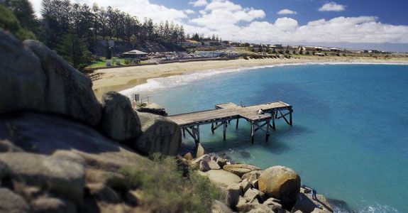
Local Area History
A brief look at the history behind the discovery of the Encounter Coast of South Australia.
1802 chance meeting of Matthew Flinders and Nicholas Baudin on their voyages of discovery.
As the 19th century dawned it was firmly believed that the far away continent of Australia was two huge islands. It was left to two explorers, whose chance meeting off the coast of South Australia, near the mouth of the Murray River, whilst on separate voyages of discovery, to prove otherwise. Indeed much of the mapping of the Australian coastline, including Tasmania and Kangaroo Island, has been credited to these two explorers.
Nicholas Baudin, a Frenchman in his ship the Le Geographe, met by chance, English explorer Matthew Flinders in his ship HMS Investigator, in what is now known as Encounter Bay, on the 8th April 1802. Their position was 35 degrees 40 minutes south, and 138 degrees 58 minutes east. On leaving their homelands both explorers had been given documents stating that their trips were of an exploratory nature and hence the meeting was cordial in spite of the fact that both nations had been at war since 1793.
Flinders had explored much of the coast line north and south of the new colony of New South Wales, sailed through Bass Strait and circumnavigated Van Dieman’s Land during his stay of five years there as a young naval officer. He returned to England in 1800 and after submitting a detailed report was engaged to further the exploration of the coastline of Terra Australis. He sailed from Portsmouth England on the 18th July 1801, and after a brief stop in Cape Town, South Africa he made landfall at Cape Leeuwin, Western Australia on 6th December and began charting the southern coastline.
After setting sail some nine months before Flinders, Baudin had reached the same point in May 1801, and had no knowledge of the voyage of Flinders and the Investigator. With supplies running short they decided to head north to the Dutch colony of Timor for the winter and charted much of the west and north west coast as they went. In the middle of November they resumed their voyage, rounding Cape Leeuwin in the first days of 1802, unaware that the Investigator was anchored in King George Sound only 260 kilometers to the east.
The separate voyages of discovery by Baudin and Flinders culminated in the first complete maps of the Australian coastline. Around 1990 a tourist promotion initiative, taken by a group formed from local tourist orientated commercial interests, adopted the name “Encounter Coast” for this section of the South Australian coastline, from Victor Harbor in the West to Goolwa and the Coorong in the East, in honour of the meeting of the two explorers. Celebrations to commemorate the bi-centenary of “The Encounter” in the year 2002 were held and a re-enactment of this historic meeting is now held annually.